How to Get Around The Scottish Highlands Without Speaking the Language
What this guide solves
Language is not the real obstacle in the Scottish Highlands — transport frequency is. English is the everyday language, signage is easy to navigate, and the practical challenge is building your trip around a small number of transport hubs and checking the last bus or train before you leave. Inverness, Fort William and Aviemore are the easiest bases; remote glens, islands and scattered trailheads require much more timetable discipline.
Before you start
If you are worried about 'not speaking the language', the important correction is that English is the normal language for visitors. You may see Gaelic on signs and place names, but you do not need Gaelic to use buses, trains, shops or accommodation. The real skill is understanding how rural public transport behaves differently from city transport.
The first thing to know: this is not actually a language problem
The title reflects a real travel anxiety, but in the Scottish Highlands the fear is usually aimed at the wrong thing.
You do not need Gaelic to move around the Highlands.
You will see Gaelic on signs. You will hear strong local accents. Some place names will look impossible to pronounce the first time you see them. None of that stops you buying a ticket, asking for a platform, checking into a hostel or using a bus.
The harder problem is frequency.
A city traveler thinks in distance: “That place is only 25 miles away.”
A Highlands traveler needs to think in departures: “There are three buses today, and the last one back leaves at 16:40.”
That shift is the difference between a relaxed no-car trip and a day spent staring at a bus stop wondering how much a taxi will cost.
The three bases that make a no-car trip much easier
Inverness: best all-round hub
VisitScotland describes Inverness as the main hub of the Highlands. That is exactly how you should use it.
It works well for:
- Loch Ness and the Great Glen corridor.
- Culloden and nearby historical sites.
- Nairn and Moray-side day trips.
- Rail links south toward Aviemore and Perth.
- Longer coaches toward the west and north.
The center is compact enough to walk, and bus and rail stations sit close to each other. That sounds like a small detail until you are transferring in rain with luggage.
Fort William: best for the west Highlands
Fort William is the better base if your trip is about Glencoe, Glen Nevis, Ben Nevis or the West Highland Line.
VisitScotland notes that the town is linked by both train and coach and that the center itself is small and walkable. It also sits on the scenic rail line toward Mallaig.
The practical advantage is that you stop trying to “day-trip into the west Highlands” from somewhere too far away.
Aviemore: best for Cairngorms access
Aviemore is the transport-friendly answer to a common planning mistake: sleeping in Inverness or Edinburgh and wasting half the day reaching the mountains.
If Cairngorms walks and scenery are the point of the trip, stay where the buses and trails actually begin.
The operators you need to know
You do not need fifteen transport apps. You need to understand which tool solves which problem.
Stagecoach
Stagecoach runs a large share of local and regional bus services across the Highlands.
In 2026, this matters even more because participating Highlands services are part of a Scottish Government fare-cap pilot that can reduce single bus journeys to £2. VisitScotland currently promotes the offer to visitors as well as residents.
Cheap does not mean frequent, though. Always check the timetable before building the day.
Scottish Citylink
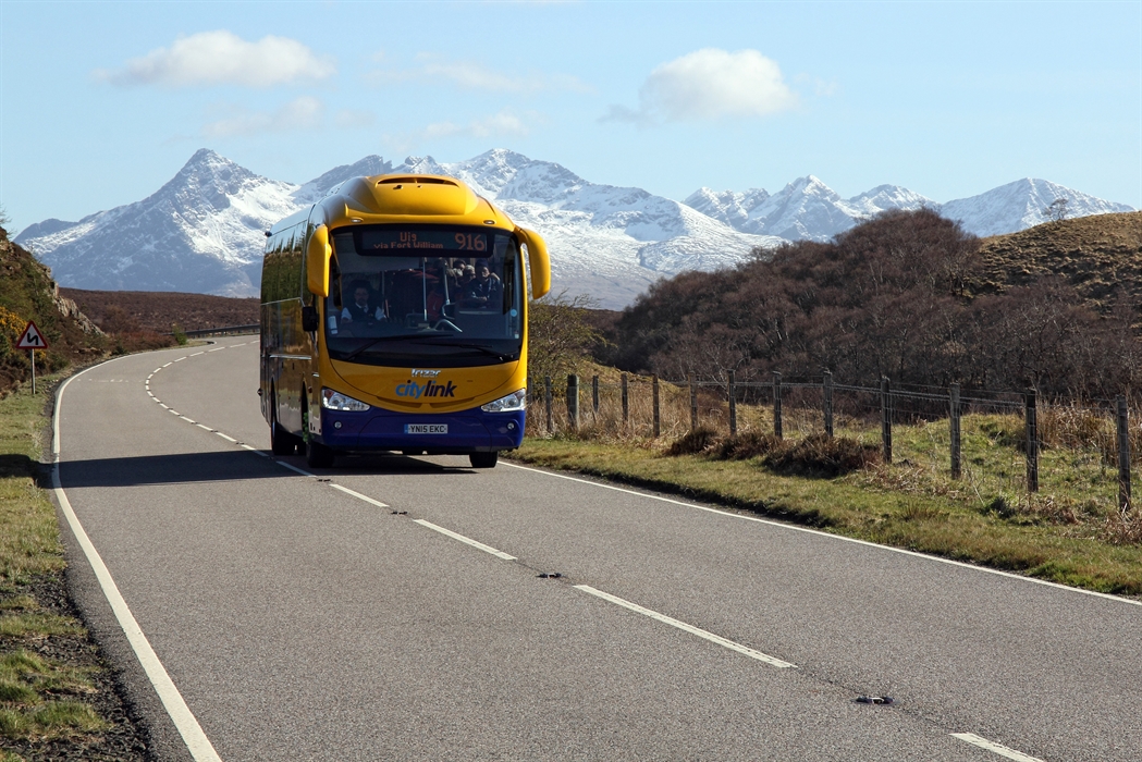
Citylink is important for longer coach corridors, particularly routes linking Glasgow, Fort William, Glencoe, Inverness and Skye-related connections.
If your route looks too long for a local bus, Citylink is often the next place to check.
ScotRail
Rail is useful because it is predictable and comfortable, but the map is not dense.
Useful rail towns include Inverness, Aviemore, Fort William, Wick and Thurso. VisitScotland specifically notes that many rail-served Highland locations can be reached from Inverness.
One warning: rail geography is not the same as road geography. Inverness to Fort William, for example, is not a simple direct rail hop in the way the map may make you expect. A bus can be more practical.
Traveline Scotland
Use Traveline when one journey crosses multiple operators. It helps answer the question “How do I actually get from this hostel to that trailhead?” rather than forcing you to search three separate websites blindly.
Then verify the final leg with the operator itself.
Build the return journey first
This is the single most useful rule in the article.
Before you plan the castle, hike, loch cruise or café stop, check how you are getting home.
Suppose the last realistic bus back to Inverness leaves at 17:10.
That becomes the hard edge of the day.
Your sightseeing schedule must fit inside it. Not the other way around.
In a city, missing one subway means waiting six minutes. In a rural corridor, missing one bus can mean waiting three hours — or waiting until tomorrow.
A real example: Inverness to Loch Ness
Loch Ness is one of the easier no-car objectives because it runs south from Inverness toward Fort Augustus and sits on established road and coach corridors.
A sensible day is:
- Leave Inverness in the morning.
- Visit one main stop — for example the Urquhart Castle / Drumnadrochit area.
- Keep enough margin to catch a confirmed return service.
- Do not add three extra villages simply because they appear nearby on Google Maps.
The mistake is trying to “do the whole loch” in one improvised public-transport day.
The better approach is one area, properly.
A real example: Glencoe without a car
Glencoe looks close to everything on a Scotland map because Scotland itself is not huge.
In travel-time terms, it behaves differently.
VisitScotland notes that Citylink coaches serve Glencoe from Glasgow and that travelers from Inverness can connect via Fort William.
That tells you something useful: Fort William is the natural transport partner for Glencoe.
If Glencoe is central to your trip, base on the west side rather than forcing a cross-country day from Inverness.
This is the kind of planning choice that improves both the budget and the experience.
How much timetable buffer is enough?
For a same-operator connection at a staffed town station, 15–20 minutes is usually comfortable.
For a rural bus-to-bus connection, I would want more.
For a connection involving a ferry, a last service of the day, or a trail finish whose timing depends on weather, I want a lot more.
The correct buffer is not a universal number. It depends on the consequence of failure.
Ask:
- Is there another service after this one?
- Is there a café, hotel or station nearby if I have to wait?
- Is a taxi realistically available?
- Do I have phone signal?
- Is this the last connection of the day?
If missing the connection would strand you, do not plan it with a five-minute margin.
What to screenshot before leaving Wi-Fi
Make a tiny offline travel pack each morning:
- Outbound departure time.
- Exact stop name.
- Return departures — plural, not just one.
- Operator name and route number.
- Accommodation phone number.
- One local taxi number for genuinely remote days.
- A map pin for the stop you need to return to.
This sounds excessive until the weather turns, your battery is at 18%, and the stop has no timetable board.
Place names: how to ask without feeling ridiculous
You do not need perfect pronunciation.
Show the destination on your phone.
Say the town name as best you can and let the driver or station staff correct you if necessary. Transport staff are used to visitors encountering Gaelic and Scots place names for the first time.
For tiny rural stops, it is often helpful to tell the driver where you are getting off when you board.
The social friction is much smaller than travelers imagine.
The routes that are easiest without a car
As a planning rule, these are much friendlier:
| Base | Good no-car targets | Why it works |
|---|---|---|
| Inverness | Loch Ness, Culloden, Nairn, Aviemore | Strong bus + rail hub |
| Aviemore | Cairngorms area | Sleep close to the landscape |
| Fort William | Glencoe, Glen Nevis, Mallaig line | Strong west-Highland base |
| Glasgow | Glencoe / Fort William corridor | Direct long-distance coach access |
And these require more care:
- Remote Skye stops away from main bus corridors.
- North Coast 500-style point-to-point sightseeing.
- Small trailheads with one or two buses a day.
- Multi-island journeys involving ferries and buses on the same day.
- “Scenic stops” that are roadside viewpoints rather than actual settlements.
Why taxis are not a planning strategy
In a city, “we can always get a taxi” is a reasonable backup.
In a rural glen at 7pm, it may not be.
There may be one local taxi company serving a large area. The driver may already be booked. Ride-hailing coverage can be inconsistent. And a long rural taxi can cost more than several days of bus travel.
Use taxis selectively:
- Pre-booked transfer to a trailhead.
- Short hop when accommodation is outside town.
- Emergency backup when you genuinely miss a service.
Do not use “taxi if needed” to make an unrealistic itinerary look workable on paper.
The 2026 £2 bus fare changes the budget, not the timetable
VisitScotland currently highlights a Highlands and Islands bus initiative that caps many single bus fares at £2 during the 2026–27 pilot period.
That is excellent news for visitors.
But it solves only one half of the problem.
A £2 bus that leaves at 08:05 and 16:15 is still a bus that leaves twice a day.
Use the fare cap to save money. Do not let it tempt you into more movement than the timetable can support.
The no-car Highlands rule I would actually use
For every three nights, choose one main base.
For every sightseeing day, choose one transport corridor.
For every rural excursion, identify two possible ways back.
That is the system.
Not “speak better Gaelic.” Not “download twelve apps.” Not “wing it because Scotland is small.”
The Highlands are very manageable without a car when your itinerary follows the transport network instead of fighting it.
Sources and current transport checks
This guide is based on current transport guidance from VisitScotland’s Highlands travel information, VisitScotland’s Fort William guidance, VisitScotland’s Loch Ness guidance, and current ScotRail route information. For live journeys, verify exact departures with Stagecoach, Scottish Citylink, ScotRail and Traveline Scotland before traveling.
Step by step
- Choose a transport hub before choosing your sightseeing list. Inverness, Fort William and Aviemore give you the strongest combination of rail, coach, local bus and walkable town facilities.
- Build each day from the timetable backward. Check the final bus or train home first, then decide what you can realistically do before it.
- Use more than one operator. Stagecoach covers many local routes; Citylink is important for longer Highland corridors; ScotRail connects key rail towns; Traveline Scotland is useful for combining them into one journey search.
- Screenshot your outbound and return options before you leave Wi-Fi. Rural signal is often fine in towns and unreliable exactly where you most need reassurance.
- Keep one backup option for every rural day: an earlier return bus, a shorter walking route, or enough money for a taxi if a connection fails.
- Do not schedule two fragile connections in a row. A day that requires bus → ferry → bus with five-minute margins is not a budget itinerary; it is a gamble.
Common mistakes and how to avoid them
- Planning by road distance instead of timetable. Forty miles can be easy if one direct coach runs it, while ten miles can be awkward if the service is infrequent.
- Assuming every cheap £2 bus fare applies to every journey. The Highlands fare-cap pilot is broad in 2026, but trains, ferries and some services follow different pricing.
- Treating Inverness, Skye, Glencoe and Fort William as one compact zone. They belong to the same travel region but not to one easy daily transport loop.
- Ignoring Sunday and evening service differences. Rural frequencies can drop sharply outside the main daytime pattern.
- Relying on a taxi as an automatic backup. In remote areas taxis can be scarce, need pre-booking, and cost enough to erase a careful budget.
If your situation is different
You want Loch Ness
Base in Inverness. VisitScotland lists Inverness as the key transport hub for the Highlands, and Loch Ness stretches south from the city toward Fort Augustus. This is one of the easier no-car Highland days.
You want Glencoe
Fort William or Glasgow usually creates a cleaner route than Inverness. VisitScotland notes Citylink services through Glencoe and local connections via Fort William.
You want Cairngorms hiking
Aviemore is the obvious rail-and-bus base. It lets you sleep near the park rather than spending hours commuting in and out.
You want Skye
Treat Skye as its own transport chapter. Do not tack it onto a short Inverness itinerary just because it looks close enough on a map. Stay on the island if Skye is a priority.
Frequently asked questions
Do I need to speak Gaelic in the Scottish Highlands?
No. You will see Gaelic on some road signs, stations and place names, but English is the everyday language used for transport, accommodation and visitor services.
Can I travel the Scottish Highlands without renting a car?
Yes, especially if you use Inverness, Fort William or Aviemore as bases. Public transport becomes much harder when you try to link remote scenic stops one after another instead of planning around established routes.
What is the best app or planner for Highland public transport?
Use operator apps for live details and Traveline Scotland for multi-operator planning. Check Stagecoach, Citylink and ScotRail directly when the exact service matters.
Are buses really £2 in the Highlands in 2026?
Many are. VisitScotland currently highlights a 2026 Highlands and Islands single-fare cap of £2 on participating bus services. Recheck the exact operator and route before travel because the pilot has specific coverage and an end date.
What should I do if I miss the last bus?
Avoid building days that depend on the final possible service. If it happens, call local taxi firms rather than assuming ride-hailing will be available, contact your accommodation if necessary, and treat the cost as an emergency expense rather than part of the normal budget.
Related downloadable
The matching printable for this guide is in progress — browse the Checklists & Printables library for other ready-to-use downloads.
Browse Checklists & Printables